Understanding cloud patterns in our changing climate is essential to making accurate predictions about their impact on society and nature.
Understanding cloud patterns in our changing climate is essential to making accurate predictions about their impact on society and nature. Scientists at the Institute of Science and Technology Austria (ISTA) and the Max Planck Institute for Meteorology published a new study in the journal Science Advances that uses a high-resolution global climate model to understand how the clustering of clouds and storms impacts rainfall extremes in the tropics. They show that with rising temperatures, the severity of extreme precipitation events increases.
Extreme rainfall is one of the most damaging natural disasters costing human lives and causing billions in damage. Their frequency has been increasing over the last years due to the warming climate. For several decades, scientists have been using computer models of the Earth’s climate to better understand the mechanisms behind these events and to predict future trends. In a new study, now published in the journal Science Advances, a team of researchers from the Institute of Science and Technology Austria (ISTA) and the Max Planck Institute for Meteorology (MPI-M) led by ISTA postdoc Jiawei Bao used a new state-of-the-art climate model to study how cloud and storm clustering impacts extreme rainfall events—specifically in the tropics—in more detail than has been possible before.
Read more at Institute of Science and Technology Austria
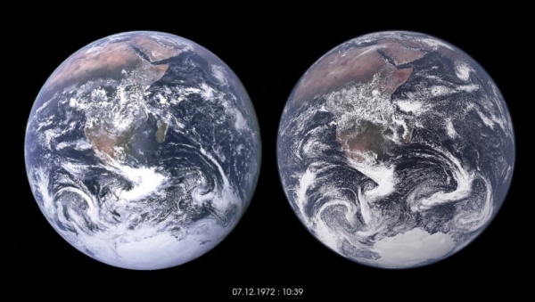
Image: Blue Marble and climate model. The left globe shows the famous “Blue Marble” photo of Earth, taken in 1972. The globe on the right shows a visualization of data from a simulation with a one-kilometer grid for the atmosphere, land, and ocean. Credit: © NASA, MPI-M, DKRZ, NVIDIA via Institute of Science and Technology Austria)


